
Route Planning
Active Travel Hub > Cycling > Route Planning
How to plan
Planning a route sounds simple but there can actually be quite a lot to consider before you get going.


Weather
The changeable weather of the Highlands will mean routes that are pleasant one day might not be the next. Try avoiding spots which often flood after heavy rain.

Time of Day
If you’re out shopping and spend more time than you envisioned, be aware that it could get dark before you cycle home!

Duration
You should consider how long you have to complete the route planned. Is it a bit of a stretch? Can you cut it short if you need to dash back quickly?

fitness
Don’t be over confident and scale up your ride too quickly. Pace yourself. It’s also worth noting that a ride involving more hills will take more effort.

gear
Largely based on the weather conditions. If it’s a traditional Scottish day then you’ll need to pack for rain, sun, snow or anything in between. Better to carry a coat and not need it than not take it and need it.

Nutrition
Make sure you’re adequately fuelled for the ride your planning. If you haven’t eaten for a while then take some snacks to sustain you. Make sure to take a bottle of water as well.
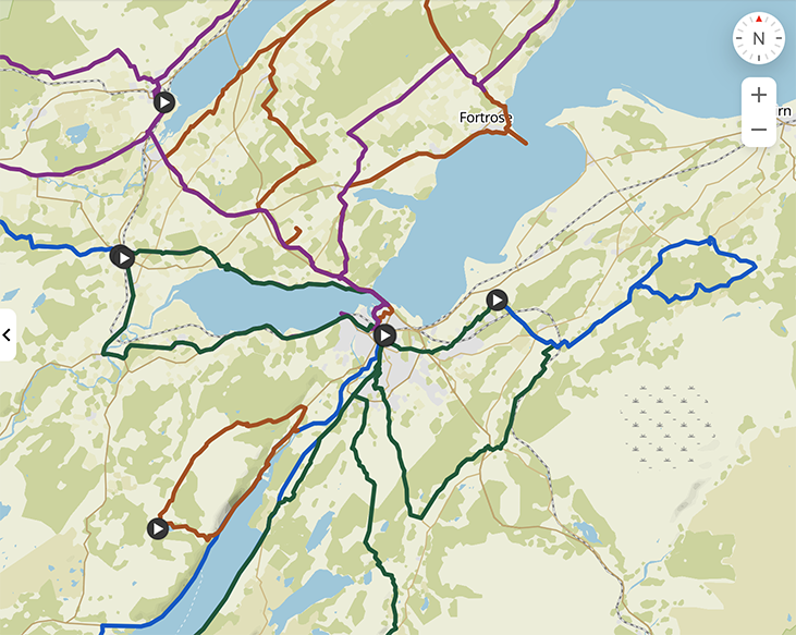
Route planning tools
As you would imagine there are a huge range of tools to help you plan routes. It can be difficult to know which one is best for your needs. This guide should help outline which tools are best and what their main functions are.

Cyclestreets
Cyclestreets is a website which allows you to plan point to point cycle journeys. There is a wealth of information available to help you make the best route choice. You can chose the fastest, balanced or quietest route. Local cycling routes are shown and you can see pictures of the infrastructure, which helps if you want to see if there’s somewhere to lock your bike up when you arrive.
Komoot
Komoot is a route planning tool, available either on the web or as an app on your phone. As well as allowing you to plan a variety of on road or off road route options, it also features a variety of user created routes, showcasing popular places to visit both on bike and on foot. It features voice guidance when using your phone on the move so you don’t need to stop and look at your screen every 2 minutes.

google maps
Google maps is the most used and well known mapping software which most of us have access to. You can check out specific junctions before heading out, but remember to check the date of the photo to ensure it’s a recent picture. Google does have a cycling specific mode which will direct you on more cycling friendly roads, but exercise a bit of caution when using this as Google might not have the most up-to-date infrastructure for cycling. It might suggest you ride along a main road when there is a bike route alongside it. Never blindly follow your phone!
